Cape Grim, Australia
Description
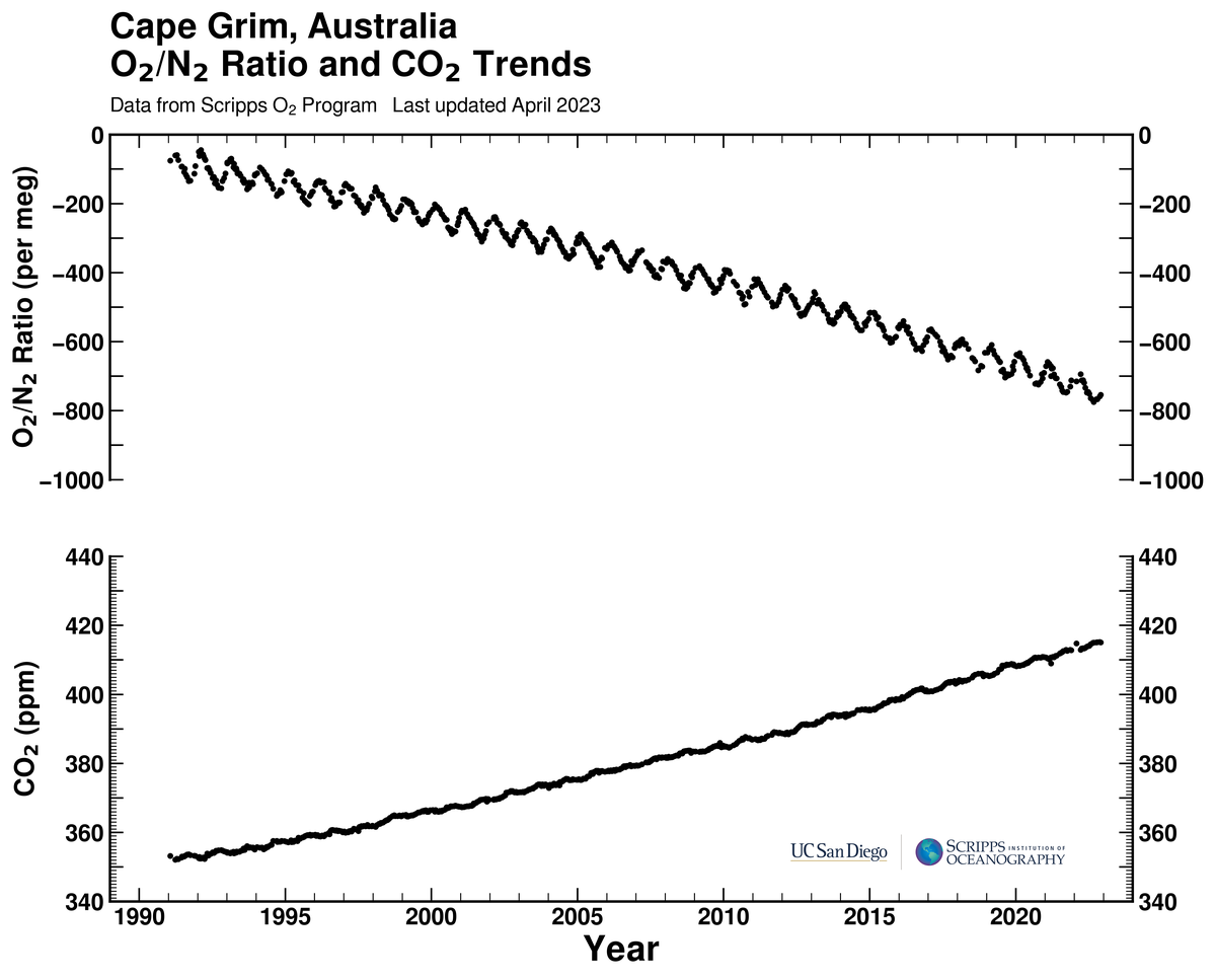
O2/N2 and CO2 flask data taken at Cape Grim, Australia: Latitude 41°S Longitude 150°E Elevation 91m.
O2/N2 and CO2 flask data taken at Cape Grim, Australia: Latitude 41°S Longitude 150°E Elevation 91m.
Scripps O2 program data and graphics onscrippso2.ucsd.edu are licensed under a CC BY license, Creative Commons Attribution 4.0 International License (http://creativecommons.org/licenses/by/4.0/), which clarifies appropriate uses and requirements, including that credit be given to the Scripps Institution of Oceanography at UC San Diego.
Ethical usage may also require disclosing intentions at early stages to avoid duplicating ongoing studies at Scripps or elsewhere. For applications supporting peer-reviewed scientific publications, coauthorship may sometimes be appropriate. An example would be if an important result or conclusion depends on this product, such as the first account of a previously unreported phenomenon.
Please direct queries to Ralph Keeling (rkeeling@ucsd.edu)